The Piri Reis map of 1513: a portolan chart with Columbus as a source
In the library of the Topkapı Palace in Istanbul lies a piece of parchment with the Atlantic Ocean on it: the coasts of Spain and West Africa on one side, South America and the islands of the Caribbean on the other. It is the surviving part of a world map that the Ottoman sea captain Piri Reis drew in 1513. On the map he wrote where his information came from, including a map by Christopher Columbus.
Piri Reis
Piri Reis ('captain Piri') lived from about 1470 to 1554. Almost nothing is known about him outside his own works. As a young man he sailed with his uncle Kemal Reis, a corsair who later became an admiral in the Ottoman navy. Piri Reis himself was named admiral of the fleet of Egypt and India in 1547, led a failed expedition against the Portuguese at Hormuz, and was executed in Cairo in 1554.
The map
According to its Arabic colophon, the map was made in Gallipoli in the month of Muharram of the year 919, that is March or April 1513. In 1517 Piri Reis presented it to Sultan Selim I in Cairo.
Only the western part survives, drawn on a piece of gazelle or deer hide of about 90 by 63 centimeters; the curve in one corner follows the neck and shoulder of the animal. It is kept in the library of the Topkapı Palace Museum under the number R. 1633 mük. Some image websites give the number H 1824; that belongs to a second, later map by Piri Reis, from 1528.
The map lay forgotten until 1929, when it was found while the Topkapı Palace was being turned into a museum. The German orientalist Paul Kahle published it in 1933, and in 1935 the Turkish Historical Society issued a facsimile with the inscriptions translated into several languages.

A portolan chart
In structure and style the map is a portolan chart, like the charts on our page about sea charts with compass lines. Five compass roses survive, and the web of lines runs from them. The center of the circle on which the roses lie can be placed roughly in the Sahara, near the Tropic of Cancer.
An inscription explains the signs along the coasts: cities and citadels are marked with red lines, uninhabited places with black lines, rocky places with black dots, shallows and beaches with red dots, and submerged rocks with crosses.
What Piri Reis wrote about his sources
In a long inscription Piri Reis explains how he made the map: from about twenty charts and world maps, among them old maps of the inhabited world, an Arabic map of India, Portuguese maps of the countries of India and China, and a map by Columbus of the western region. He brought them all to one scale.
“… and also from a map drawn by Colombo in the western region I have extracted it. By reducing all these maps to one scale this final form was arrived at.”
Another inscription tells that his uncle Kemal Reis had a Spanish slave who said he had sailed three times with Columbus to the new lands, and it states that the coasts and islands on the map are taken from Columbus's map. According to the historian Svat Soucek, the slave was probably taken prisoner when Kemal Reis captured Spanish ships off Valencia in 1501.
“The coasts and islands on this map are taken from Colombo's map.”
Columbus as a source
Columbus made a map during his third voyage and sent it to Spain in 1498; that map is lost. That is why the Piri Reis map has attracted so much attention since 1929.
The influence of Columbus can be seen in the Caribbean on the map. Compared with a modern map, Hispaniola is turned by about ninety degrees, and Cuba is drawn as a wedge of land attached to the mainland, as Columbus believed it to be.
How direct the link is remains uncertain. According to Soucek, it is an assumption ('we assume') that the slave owned a copy of the map of 1498. The historian of cartography Almagià compared the place names and concluded that the map shows 'the imprint of Columbus', rather than the lost map itself.
The Book of the Sea
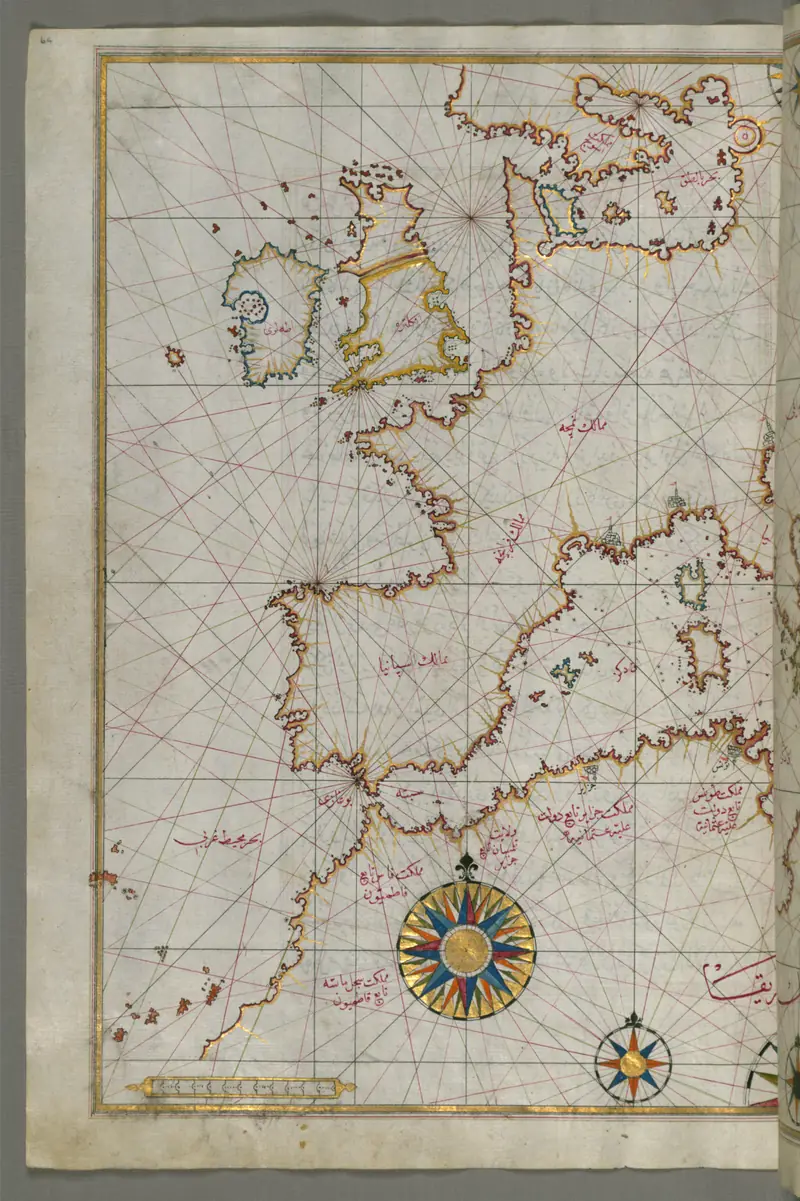
After 1511 Piri Reis also began his Kitab-ı bahriye, the 'book of maritime matters': sailing directions for the Mediterranean, each chapter with a chart, in a shorter version of 1521 with 130 charts and a longer one of 1526 with 210. They survive only in copies by other hands.
In it he discusses storms and winds, the compass, portolan charts and navigation by the stars, and he explains why he wrote at such length:
“Such knowledge cannot be known from maps; it must be explained. Such things cannot be measured with dividers.”
And Antarctica?
In 1966 Charles Hapgood argued in his book Maps of the Ancient Sea Kings that the map was drawn on a projection centered on Cairo, and that the coast at the bottom shows Antarctica before it was covered by ice, copied from the maps of an advanced civilization of the Ice Age.
Historians of cartography do not follow him. Soucek calls Hapgood's ideas the most improbable of the many speculations about the sources of the map, and gives two plain observations: the map is drawn on the shoulder of an animal hide and is therefore curved in one corner, and chartmakers often bent a coastline to fit the space they had.
The map itself says something else about that land. An inscription on the southern coast calls the country a waste where large snakes are said to live and which is very hot; elsewhere Piri Reis writes that the Portuguese drew this coast on their maps. That fits the coast of South America as the Portuguese knew it in 1513, not an Antarctica without ice.
What we do not know
- Did the Spanish slave really own a copy of Columbus's map of 1498? The map does not say so outright.
- What did the whole map look like? Only the western part survives; reconstructions of the rest are guesswork.
- How exactly do the inscriptions read in Ottoman Turkish? We have read them only in the English translation of 1935.
- What do Hapgood, Kahle and McIntosh write in detail? We have not read their books ourselves; what we say about Hapgood comes from Soucek.
Sources
- Svat Soucek, 'Islamic Charting in the Mediterranean', in The History of Cartography, vol. 2, book 1 (Chicago 1992), pp. 263–292. press.uchicago.edu
- Yusuf Akçura, Piri Reis Haritası (Istanbul: Türk Tarih Kurumu, 1935), the English section with the translated inscriptions I–XXIV. en.wikisource.org
- Charles H. Hapgood, Maps of the Ancient Sea Kings (1966; revised 1979): not read by us, cited after Soucek.
- Paul Kahle, Die verschollene Columbus-Karte von 1498 in einer türkischen Weltkarte von 1513 (Berlin 1933): not read by us.
- Gregory C. McIntosh, The Piri Reis Map of 1513 (Athens, Georgia, 2000): not read by us.