Arabic astronomy · Islamic calendar
Moon sighting: where will the new crescent be visible?
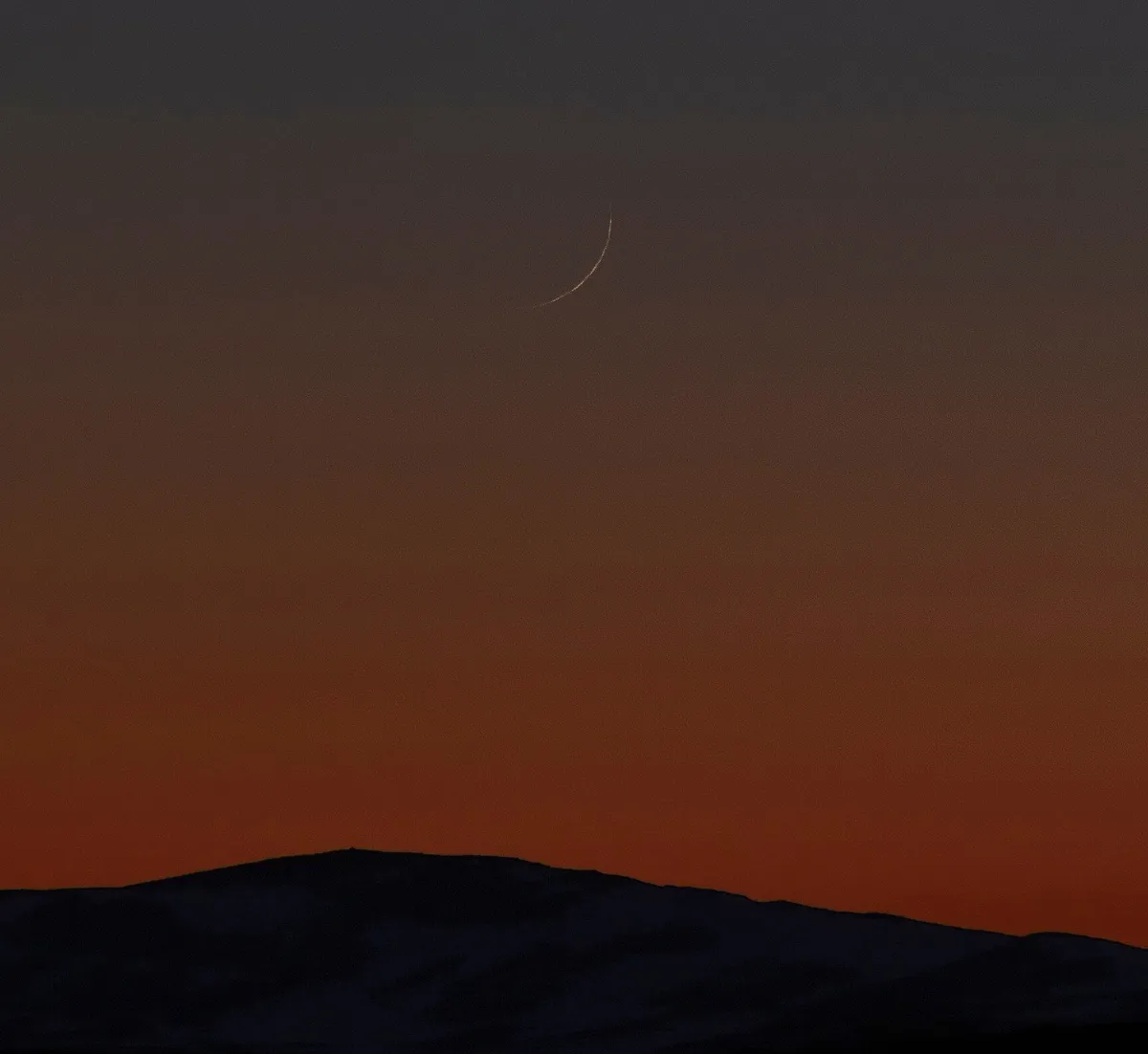
A new Islamic month traditionally begins when the thin crescent is seen in the evening sky after the new moon. These maps show where that is possible, on the evening of the conjunction and the two evenings after it.
The crescent of Rajab 1448 AH
Astronomical new moon (conjunction): 9 December 2026 at 00:52 UTC. Expected start of Rajab in the Umm al-Qura calendar: Thursday, 10 December 2026.
These dates are calculated. The start of a month is decided by religious authorities, nationally or locally, often after the new crescent has been seen. Where you live, a month may begin a day later than shown here, and occasionally a day earlier.
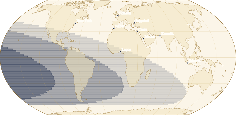
- Visible to the naked eye
- Visible with optical aid, and possibly to the naked eye
- Visible with optical aid only
- Not visible, even with optical aid
- Not calculated (beyond 60° latitude)
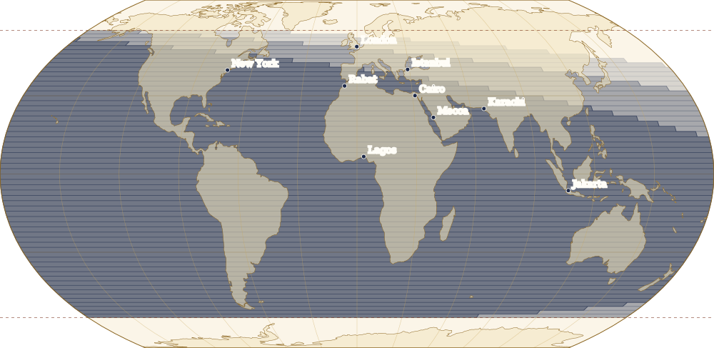
- Visible to the naked eye
- Visible with optical aid, and possibly to the naked eye
- Visible with optical aid only
- Not visible, even with optical aid
- Not calculated (beyond 60° latitude)
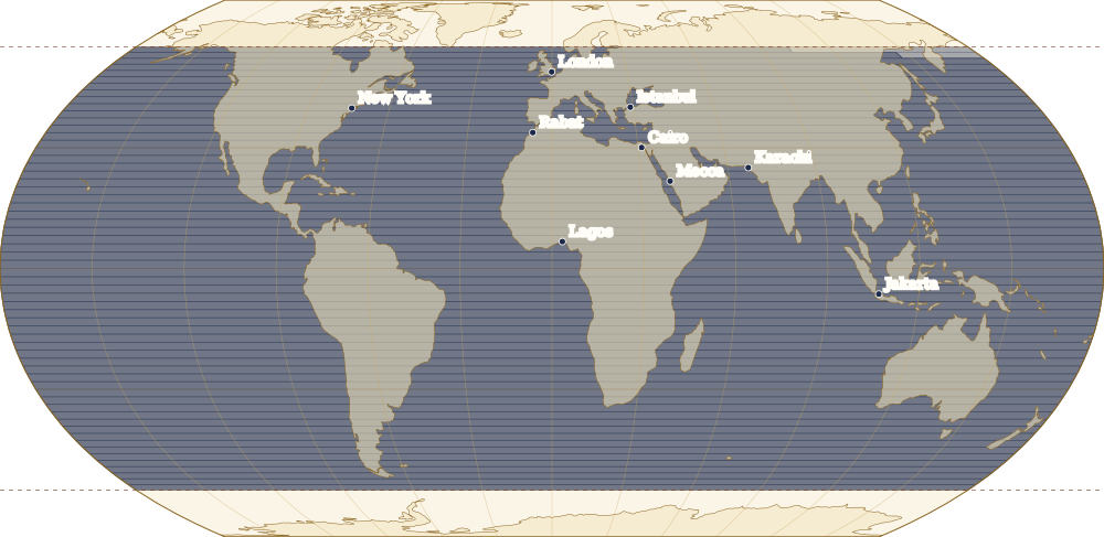
- Visible to the naked eye
- Visible with optical aid, and possibly to the naked eye
- Visible with optical aid only
- Not visible, even with optical aid
- Not calculated (beyond 60° latitude)
All months
Maps for every month from Muharram 1448 to Muharram 1450 AH.
- Muharram 1448
- Safar 1448
- Rabi al-Awwal 1448
- Rabi al-Thani 1448
- Jumada al-Ula 1448
- Jumada al-Akhirah 1448
- Rajab 1448
- Shaban 1448
- Ramadan 1448
- Shawwal 1448
- Dhu al-Qadah 1448
- Dhu al-Hijjah 1448
- Muharram 1449
- Safar 1449
- Rabi al-Awwal 1449
- Rabi al-Thani 1449
- Jumada al-Ula 1449
- Jumada al-Akhirah 1449
- Rajab 1449
- Shaban 1449
- Ramadan 1449
- Shawwal 1449
- Dhu al-Qadah 1449
- Dhu al-Hijjah 1449
- Muharram 1450
How we calculate visibility
For every square of 2° on the map we take the moment of sunset and of moonset at sea level. The best time to look is four-ninths of the interval between them after sunset. At that moment we calculate how high the Moon stands above the Sun, seen from that place, and how wide the lit crescent is.
These two values decide the zone, according to the criterion that Mohammad Odeh published in 2004 from 737 observations of the crescent. Zone A means the crescent should be visible to the naked eye in a clear sky; in zone B optical aid helps, and the naked eye may succeed; in zone C only binoculars or a telescope will show it; in zone D it cannot be seen.
The maps assume a clear sky and a flat horizon. Haze, clouds, mountains, light pollution and the observer’s experience all matter. Beyond 60° latitude we do not calculate: Odeh’s observations hardly reach that far, and in summer the Sun barely sets there.

How we checked it
We compared our calculation with 160 of the 737 observations published by Odeh, one full page of his table for each zone. At his times of observation our values agree within his rounding, and the zone is the same except within a few hundredths of a zone boundary. A second, independent calculation with other software gives the same results.
Sources
- Mohammad Sh. Odeh, ‘New Criterion for Lunar Crescent Visibility,’ Experimental Astronomy 18 (2004): 39–64, doi:10.1007/s10686-005-9002-5. doi.org
- Robert H. van Gent, ‘The Umm al-Qura Calendar of Saudi Arabia,’ Utrecht University, webspace.science.uu.nl/~gent0113/islam/ummalqura.htm (consulted 13 November 2026). webspace.science.uu.nl
- Positions of the Sun and Moon: Astronomy Engine by Don Cross (MIT License), checked against a second calculation with Skyfield and the JPL DE440 ephemeris. github.com · rhodesmill.org
- Coastlines: Natural Earth (public domain). naturalearthdata.com